MSM126 - Physical Oceanography Madeira

GEOMAR_Logo GEOMAR_Logo ARDITI_Logo

Cruise name: MSM126 "Jellyweb Madeira"   Vessel: RV MARIA S. MERIAN   Duration: February 9 to March 4, 2024
Start harbor: Funchal, Madeira   End harbor: Las Palmas, Gran Canaria
Partners: GEOMAR Kiel, Germany; ARDITI Madeira, Portugal; University of Southern Denmark; Smithsonian Museum of Natural History, USA; University of Hamburg, Germany
Cruise area: Madeira marine habitats from depths of 50 m to 4000 m


The focus of MSM126 lies on the pelagic deep sea, which belongs to the least explored ecosystems on earth. We will work in the area off Madeira Island in the North Atlantic Ocean. Research aims include the documentation of biodiversity and of the vertical and horizontal distribution of species in relations to physical and chemical parameters and oceanographic features, food web relations, and the role of pelagic fauna in transferring carbon to the seafloor. A particular knowledge gap concerns the biodiversity and functional role of gelatinous macrozooplankton (the “jelly web”) in pelagic oceanic food webs. Our work aims to address the current knowledge gaps biodiversity exploration and dedicated sampling of representatives of all trophic levels of the food web. The cruise will be embedded in ongoing work to unravel the biodiversity and food webs in the Macaronesian Island region, with a focus on gelatinous macrozooplankton. We will use a wide range of established and novel in-situ observation (pelagic and benthic towed camera observation sytems, remotely operated vehicle ROV PHOCA) and sampling technology (various nets, ROV PHOCA samplers), coupled to state-of-the-art laboratory analyses, including metagenomics approaches and stable isotope analysis, focusing on Madeira as the least explored of the Macaronesian Islands. The intense measurements and observations as well as sampling efforts (and subsequent laboratory analyses) focusing on a small area have the potential to lead to major advances in the functional understanding of the deep-sea systems, including the role of the jelly web, of Madeira. Ultimately, we hope that the resulting scientific understanding has the potential to contribute to the protection and sustainable management of Madeira marine ecosystems and biodiversity.


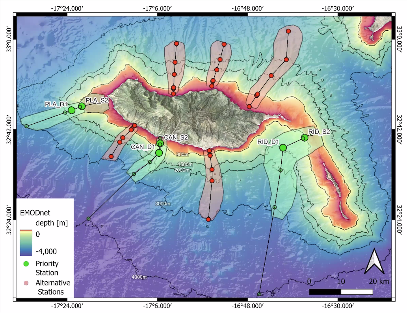
Fig 1) Working areas in Madeira


CHLA

CHLA: North Atlantic Ocean Colour Plankton, Reflectance, Transparency and Optics L3 NRT daily observations
Spatial resolutions: 1 km and a finer resolution based on olci 300 meters inputs.


SST

SST: High Resolution ODYSSEA L4 Sea Surface Temperature Analysis
Sea Surface Temperature analysis aims at providing daily gap-free maps of sea surface temperature, referred as L4 product, at 0.02deg x 0.02deg horizontal resolution, using satellite data from both infra-red and micro-wave radiometers. It is the sea surface temperature operational nominal product for the Northwest Shelf Sea and Iberia Biscay Irish Seas.


Sea Level Anomaly

SLA: European Seas Gridded L 4 Sea Surface Heights And Derived Variables Nrt
Altimeter satellite gridded Sea Level Anomalies (SLA) computed with respect to a twenty-year [1993, 2012] mean. The SLA is estimated by Optimal Interpolation, merging the L3 along-track measurement from the different altimeter missions available.


Eddy detection and tracking

Eddy detection and tracking done with AMEDA. Detection is based on geostrophic velocities and Absolute Dynamic Topography (ADT) from AVISO 0.125º resolution (European Seas Gridded L 4 Sea Surface Heights And Derived Variables Nrt). Blue and red colors represent cyclonic and anticyclonic eddies, respectively. Yellow and green contours represent potential merging and splitting events, respectively.


Forecasts

Forecasts are provided by the Oceanic Observatory of Madeira: https://oom.arditi.pt using the COAWST ('Coupled Ocean Atmosphere Wave Sediment Transport') model with a spatial resolution of 1 Km